|
The Story
UPDATE 060425:
Several
days ago I had sent an email to Ken Cockrell, NASA's WB-57 program
manager, asking questions about the aircraft's mission. Turns out he
was the pilot!! Here's his reply.
Brian,
I can answer your questions since I was the pilot on 13 Apr 06.
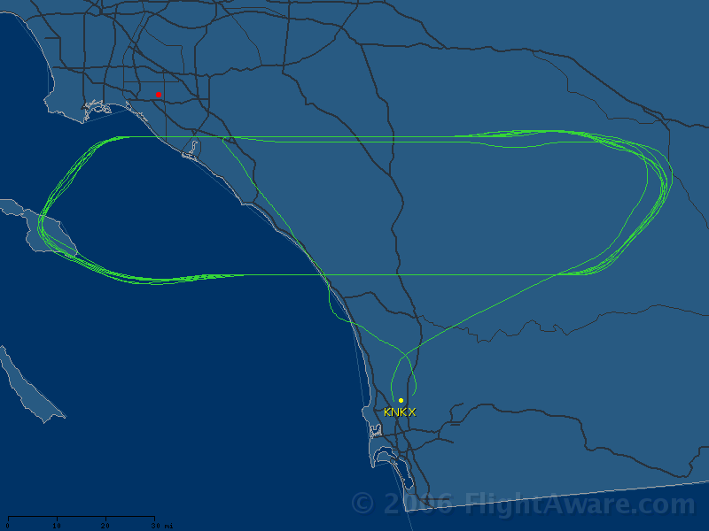
Tail number was NASA 926. We were based at MCAS Miramar and flying a
developmental communications package for an aerospace contractor. We
were flying a race track pattern stretching roughly from Palm Springs to
Catalina. The altitude was 55K ft.
I enjoyed seeing the photos.
Thanks,
Ken Cockrell
Now
that I know the aircrafts actual altitude, I can use that number to
further calibrate my optical system. My altitude determination of
70,000 feet is obviously due to the angle at which I was looking at the
plane. It was not straight up. So my result was actually the range,
which would be the hypotenuse of a triangle. The other two sides
of the triangle would be the planes actual altitude and the cross track
distance between my observing location and the plane's flight track.
UPDATE 060422:
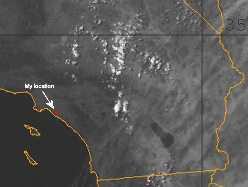
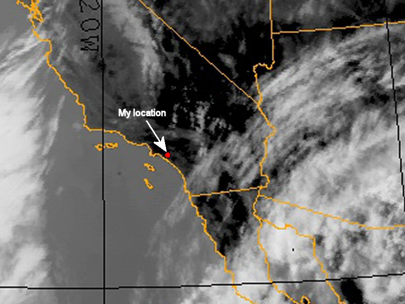
I have determined that the specific plane was NASA926. I also found this aircrafts flight track archived at FlightAware. I have added the flight track image to the bottom of the page.
ORIGINAL STORY:
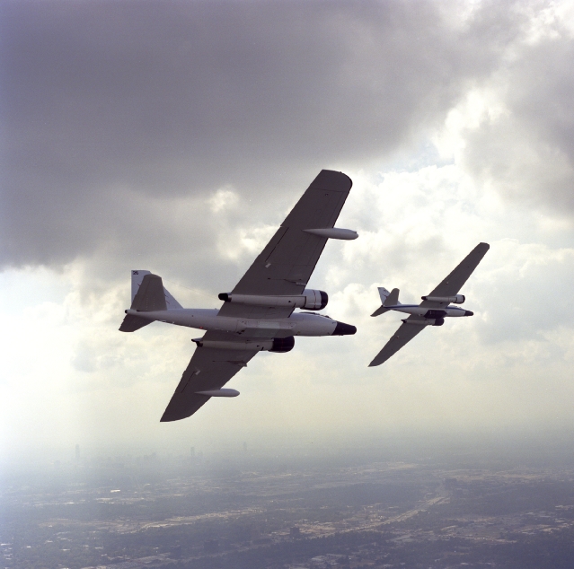
Originally, I had thought this plane was an ER-2 - the NASA version of
the famous Lockheed U2-TR1. But several people suggested it may instead
be a WB-57. Upon further analysis, I have concluded that it is indeed a
WB-57.
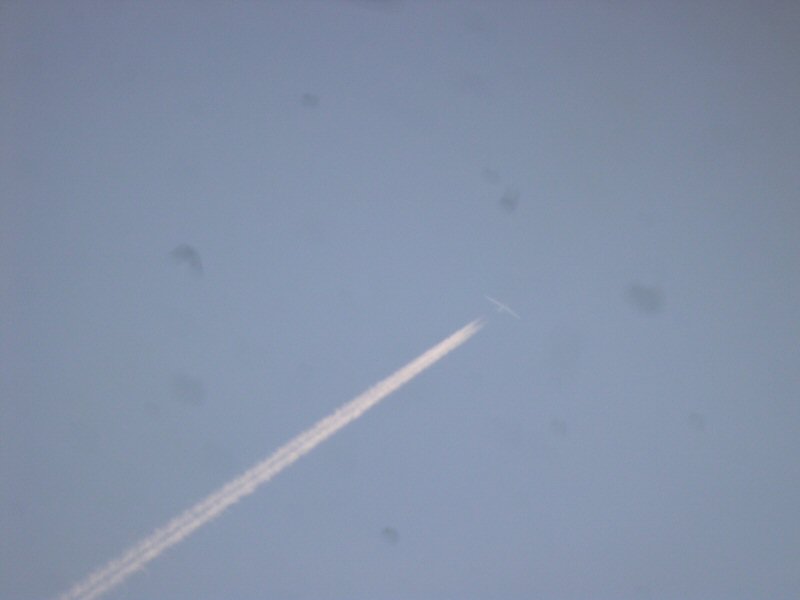
Over the past few weeks I had been catching a glimpse of one of NASA's
WB-57 high altitude research aircraft from my north Orange County, CA
location. The Martin WB-57 is a variant of the English Electric
Canberra, but with a much longer wingspan.
Being an avid amateur astronomer and aviation buff, I'm always looking
up. I'm pretty familiar with the usual routes aircraft take over the
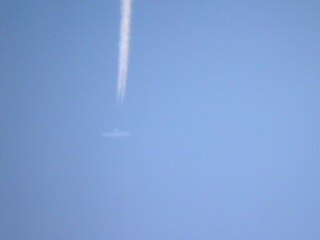
Southland. The first sighting caught my attention because it wasn't in
the usual place in the sky, was moving quite slowly, and was pulling an
unusually thin vapor trail. Since then I've seen it on at least two
more occasions.
Usually I would only catch it in binoculars. A couple times I dragged
my telescope out and viewed it that way, trying in vain to catch it
with my camera. But every time I would catch it too late and in my rush
to get everything setup, the plane would be too far away and I did not
have time to get a proper focus.
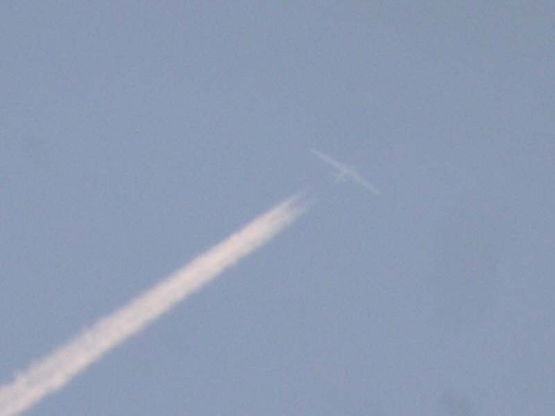
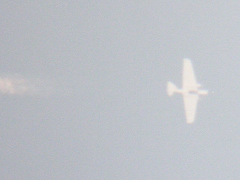
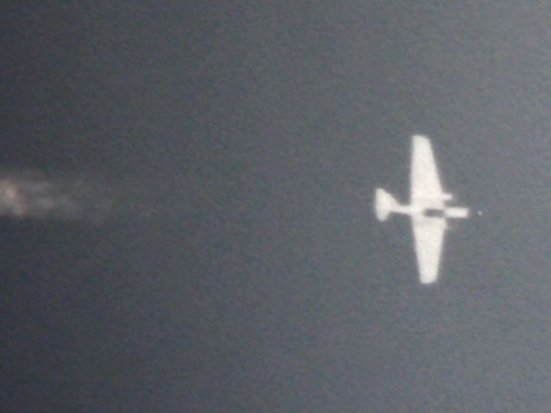
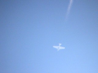
On Thursday, April 13, 2006, I had yet another chance. Like before, I
was caught by surprise and was barely able to get my telescope and
camera ready in time. I did get some images, but the plane was
already moving away. However, being such a clear day, I decided to
follow it visually through the telescope to see how far I could follow
it. I watched as it flew westward off the coast and made a lazy left
turn back inland. Knowing how high this plane usually flies, and
judging by its altitude above the horizon, it was probably down towards
San Diego. Visually it was hard to see, but through the scope it was
clear as a bell. Moving so slowly it was easy to track the plane as it
continued eastward inland.
Just as it got to my south-eastern horizon where I was about to lose it
behind buildings - it was probably in Arizona by now - I noticed it was
changing directions. Yes, it was turning left. Turning northward.
Perhaps back towards Palmdale or Edwards? I did not dare look away from
the eyepiece for fear of losing sight. It was barely visible now even
through the telescope at 30 power. It flew northward for a few moments
then, yes, it started to turn again. Left again. Back towards me! Was
it coming back for another pass? WOO HOO!! Was I excited!
This time, knowing it was coming back, and having all my equipment out
already, I could get prepared. I dragged out a small TV monitor so I
could view the image easier once I remounted the camera on the
telescope. Being a digital camera I was doing eyepiece projection,
where the camera views the image through the eyepiece just as a person
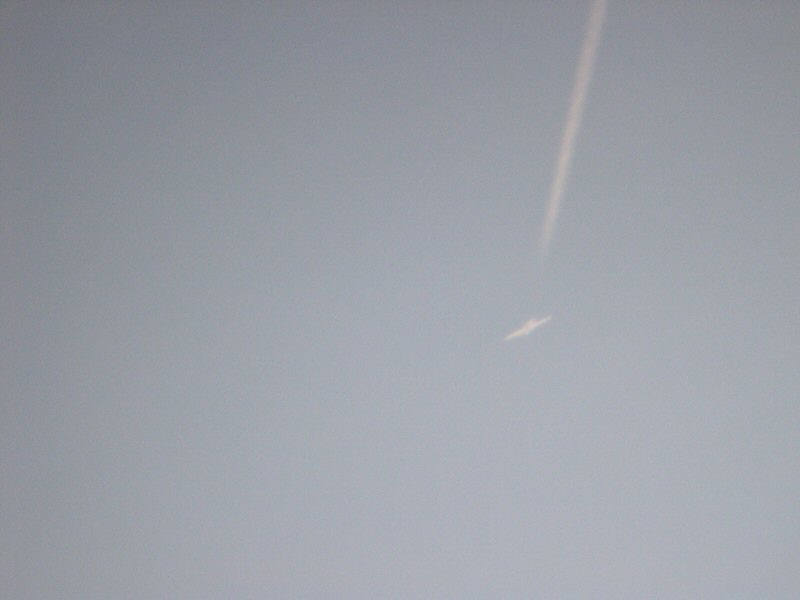
normally would. Since the plane was coming almost directly towards me
from the east to pass just south of me high overhead, I had plenty of
time to track the plane, watching the video monitor and getting the
sharpest focus.
As the plane approached zenith at perhaps no more than 10-15 degrees
from straight up, I started snapping pictures. I watched the quick view
on the monitor to see how my settings were. I was taking the pictures
in manual mode. After a few test shots I had the right exposure
settings. At closest approach I was able to get several good pictures
and a quick video. My digital camera (Nikon Coolpix 4300) can take a 40
second MOV file at 320x240 resolution.
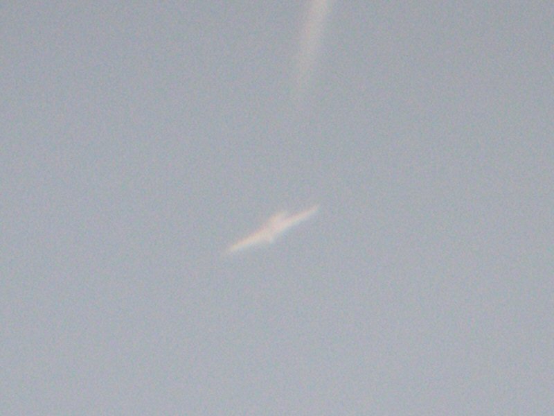
The plane was following the same path as before. Perhaps it was on a
predetermined course for whatever subject it was studying? I thought,
maybe, it might come around yet again. Since I had my pictures I
removed the camera and started following the plane visually again. As
expected, the plane followed the same left turn back inland towards
Arizona and turned back again for another pass near my location. Again,
I took more photos and another video. Afterwards I followed the plane
again, but lost it when it was out near Arizona as there were some high
clouds off in the distance. I lost the vapor trail amongst the clouds.
However, having caught three passes of the plane it was obvious it was
on a half hour repeating track. I waited another 30 minutes for the
plane to return, but it did not. It's mission was apparently finished
and presumably was returning home.
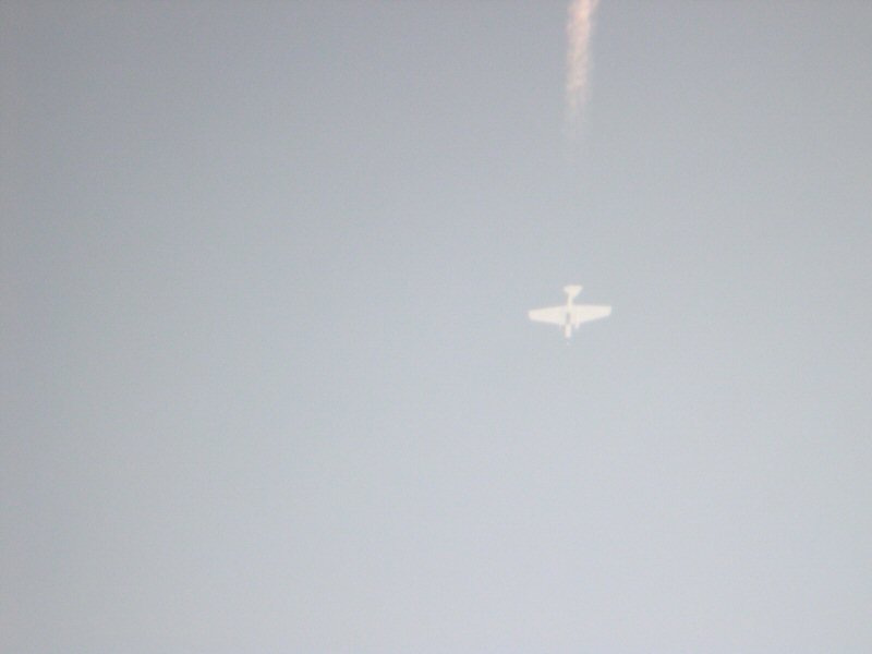
I have performed photogrammetry on the zenith image below (6th one
down) and have determined the plane was at it's normal altitude of
about 70,000 feet.
|


